Written by Ari Mayzick · Go Travel Box
Published November 12, 2026 · Updated November 12, 2026
A good hike gives you something to remember long after your shoes are clean again: an ocean view, a quiet lake, a forest full of moss, or the feeling of reaching a viewpoint under your own power.
The best hiking trails in the United States cover a wide range of experiences. Some are short scenic walks. Others involve steep climbing, altitude, exposure, or a permit. This guide helps you choose a route that fits your trip and your group, with clear distance labels, practical planning advice, and map links.
These 12 hikes are a selection across different regions, rather than one road-trip itinerary or an official ranking. Route information was checked against park information on November 11, 2026. Conditions and access must be checked again before hiking.
Planning Your First Hiking Trip? Start Here
Choose the region and season first. Then pick a route that suits the least experienced person in your group. Distance matters, but so do elevation gain, surface, shade, altitude, weather, and how long it takes to reach the trailhead.
For a first hiking holiday, stay in one area for several nights. Choose one main outing a day and keep a shorter option available. A relaxed start and enough time to turn around are more useful than an overfilled schedule.
A permit confirms permission to use a route. Your preparation and the day’s conditions determine whether it is a sensible choice.
U.S. Hiking Trips at a Glance
| Planning question | Quick answer |
|---|---|
| Best first step | Pick one region and a suitable travel season |
| Good first-trip length | Three to five days in one base |
| Shorter choices in this guide | Barker Dam, Hall of Mosses, Myrtle Falls, and Kuwohi; each has its own surface or slope considerations |
| More demanding choices | Angels Landing, Delicate Arch in heat, and uphill mountain or crater routes |
| Essential booking checks | Park entry, timed access, parking, transport, and trail permits are separate questions |
| Useful transport | A car for many trailheads, with required park shuttles used where applicable |
| Budget approach | Compare the whole regional trip, including accommodation and transport |
| Essential equipment | Suitable shoes, water, food, layers, navigation, light, and a route-specific plan |
| Access note | Short or paved does not automatically mean step-free or easy |
Table of Contents
- Planning Your First Hiking Trip? Start Here
- U.S. Hiking Trips at a Glance
- Compare 12 of the Best Hiking Trails in the United States
- The Hiking Trails: What to Expect
- Best Time to Plan a U.S. Hiking Holiday
- Booking, Permits, and Getting to Trailheads
- Where to Stay and What to Eat
- Hiking Trip Itinerary Ideas
- How Much Does a Hiking Trip Cost?
- Family, Solo, Group, and Accessible Hiking
- What to Pack and How to Prepare
- Photography and Trail Etiquette
- Important Contacts and Planning Resources
- Common Hiking-Trip Mistakes
- Frequently Asked Questions About U.S. Hiking Trips
- Your Final Hiking-Trip Checklist
- Reader Questions and Travel Experiences
- Explore More Travel Guides
- Leave a Reply
Compare 12 of the Best Hiking Trails in the United States
Distances below describe the stated route. Extra walking from accommodation, parking, or a shuttle stop can add to the day.
| Trail | Park and state | Stated distance | Main consideration |
|---|---|---|---|
| Ocean Path | Acadia, Maine | About 4.4 miles return for the full 2.2-mile one-way route | Choose a shorter section if preferred |
| Barker Dam | Joshua Tree, California | About 1.1-mile loop | Rocky desert footing and heat |
| Emerald Lake | Rocky Mountain, Colorado | About 3.4 miles return from Bear Lake | Altitude, uphill walking, and seasonal snow |
| Avalanche Lake | Glacier, Montana | About 5 miles return | Forest trail, mountain weather, and access |
| Vernal Fall footbridge | Yosemite, California | About 1.6 miles return from Happy Isles | Uphill sections and seasonal ice or repairs |
| Queen’s/Navajo combination | Bryce Canyon, Utah | About 2.9-mile loop | Climb back to the rim and seasonal route changes |
| Delicate Arch | Arches, Utah | About 3 miles return | Exposed slickrock, heat, and a narrow section |
| Hall of Mosses | Olympic, Washington | About 0.8-mile loop, plus approach | Short steep grades, roots, and wet surfaces |
| Myrtle Falls | Mount Rainier, Washington | About 1 mile return from Paradise | Snow, slopes, and steps at the viewpoint |
| Kuwohi summit | Great Smoky Mountains, Tennessee/North Carolina | About 1 mile return | Very steep paved path and seasonal road closure |
| Angels Landing | Zion, Utah | About 5.4 miles return | Strenuous climbing, exposure, and a permit for the chain section |
| Kilauea Iki | Hawaii Volcanoes, Hawaii | About 3.3-mile loop from the overlook | Steep descent and ascent, rocky ground, volcanic conditions |
Effort descriptions are practical guidance rather than a universal grading system. A route that feels comfortable in mild weather can be much harder in heat, wind, snow, or rain.
The Hiking Trails: What to Expect
1. Ocean Path, Acadia National Park
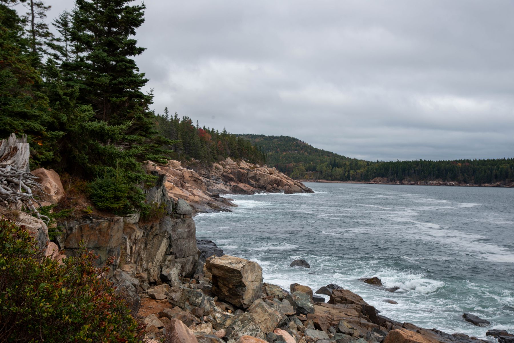
Ocean Path is a good choice if the idea of walking beside rocky Atlantic scenery appeals to you. You can select a short section or make a longer outing, with time to stop and watch the changing water.
| Detail | Planning information |
|---|---|
| Best for | Coastal views and a flexible walking day |
| Route | About 2.2 miles one way; about 4.4 miles if retracing the full route |
| Start and map | Ocean Path at Sand Beach |
| Time to allow | Two to four hours for a longer outing with stops |
| Cost and booking | Park entry applies; check road, parking, and seasonal transport arrangements |
| Access and nearby | Surfaces and crossings vary; pair a suitable section with a coastal picnic |
Choose the path rather than slippery shoreline rocks. Waves can reach farther than expected, and a rough-sea day calls for extra distance from the water.
2. Barker Dam, Joshua Tree National Park
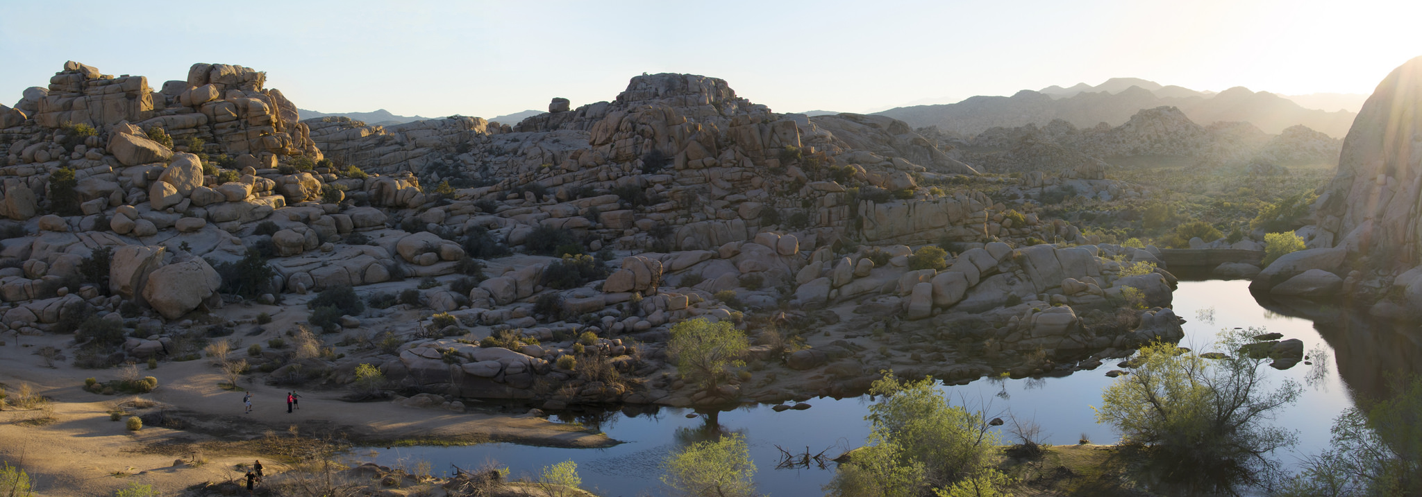
Barker Dam introduces the park’s boulders, Joshua trees, and desert plants in a compact loop. Water at the dam depends on recent weather, so a reflection is a possibility rather than a promise.
| Detail | Planning information |
|---|---|
| Best for | A short desert walk with interesting scenery |
| Route | About 1.1-mile loop with roughly 50 feet of elevation gain |
| Start and map | Barker Dam Trailhead |
| Time to allow | About 45–90 minutes |
| Cost and booking | Park entry applies; verify parking and current trail notices |
| Access and nearby | Sandy and rocky sections require suitable footing; combine with another nearby open viewpoint |
Choose a cooler part of the day and carry water even for a short walk. Leave historical features and rock art untouched, and stay on the marked route.
3. Emerald Lake, Rocky Mountain National Park
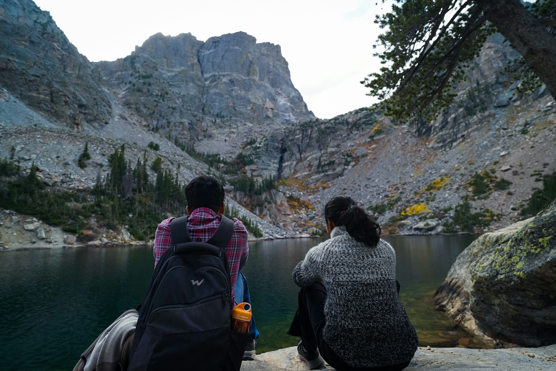
The route from Bear Lake gives you a mountain-lake outing with several places to pause along the way. It is appealing for visitors who want a clear destination and enough scenery to make the climb feel worthwhile.
| Detail | Planning information |
|---|---|
| Best for | Alpine lakes and visitors comfortable with uphill walking at altitude |
| Route | The park’s current Bear Lake Road table lists 1.7 miles one way, or about 3.4 miles return |
| Start and map | Bear Lake Trailhead |
| Time to allow | A generous half-day block with rests and access time |
| Cost and booking | Check park entry and the separate Bear Lake Road timed-access rules for your year and season |
| Access and nearby | Snow and ice can change the route substantially; confirm trail conditions before setting out |
Arrive with a realistic pace, especially if you have come from a much lower elevation. Use the operating shuttle when appropriate and keep an easier alternative available.
4. Avalanche Lake, Glacier National Park
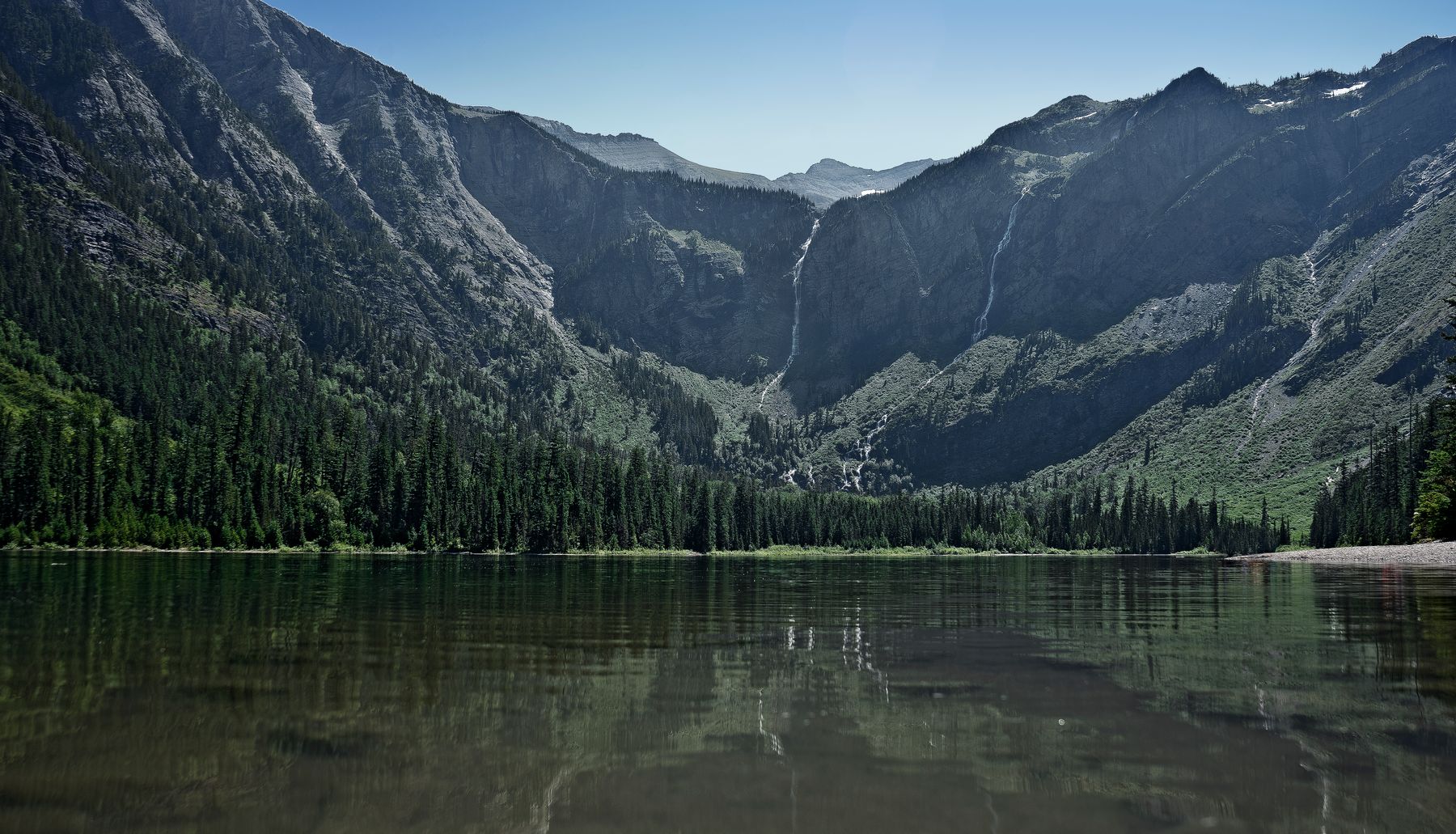
Avalanche Lake combines a forest walk with a mountain-backed destination. The journey is part of the appeal: shaded sections, running water, and a gradual change in scenery.
| Detail | Planning information |
|---|---|
| Best for | A substantial forest-and-lake outing |
| Route | About 5 miles return; the exact start and approach affect the total |
| Start and map | Avalanche Lake Trailhead |
| Time to allow | Around three to six hours, matching the park’s broad planning range |
| Cost and booking | Park entry applies; confirm road access, parking, and any seasonal vehicle rules |
| Access and nearby | A mountain trail with uneven sections; pair with suitable open areas along Going-to-the-Sun Road |
Read the park’s current bear-safety guidance and follow its instructions for your route. Do not approach wildlife or leave food unattended beside the lake.
5. Vernal Fall Footbridge, Yosemite National Park
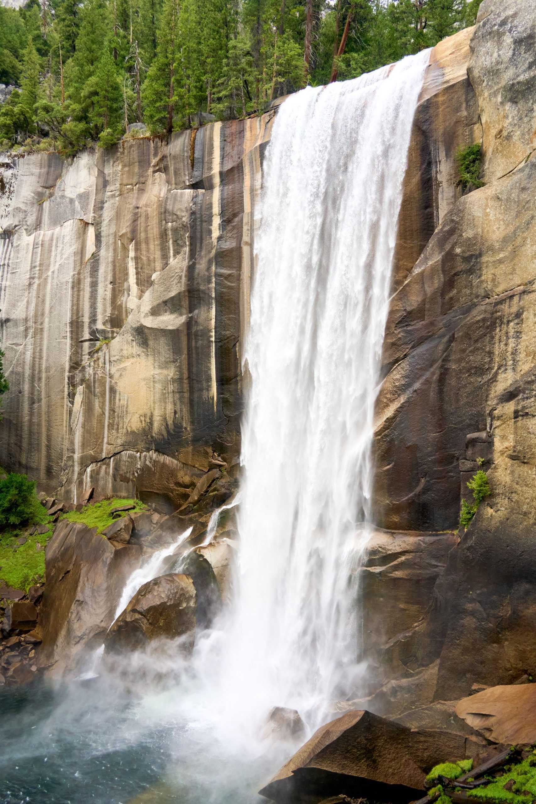
The footbridge makes a useful first hiking goal in Yosemite. It provides an uphill outing and a view toward the waterfall without automatically committing you to the steeper route above.
| Detail | Planning information |
|---|---|
| Best for | An active valley morning |
| Route | About 1.6 miles return from Happy Isles, with roughly 400 feet of elevation gain |
| Start and map | Happy Isles and Vernal Fall footbridge |
| Time to allow | Around 1.5–2.5 hours, including rests and the approach |
| Cost and booking | Park admission applies; check current repairs and seasonal closures |
| Access and nearby | Uphill grades and possible ice make this different from a flat valley path |
Treat continuing above the footbridge as a new decision. The Mist Trail’s steeper steps and seasonal restrictions need separate preparation. Keep clear of swift water and wet rocks.
6. Queen’s/Navajo Combination Loop, Bryce Canyon National Park
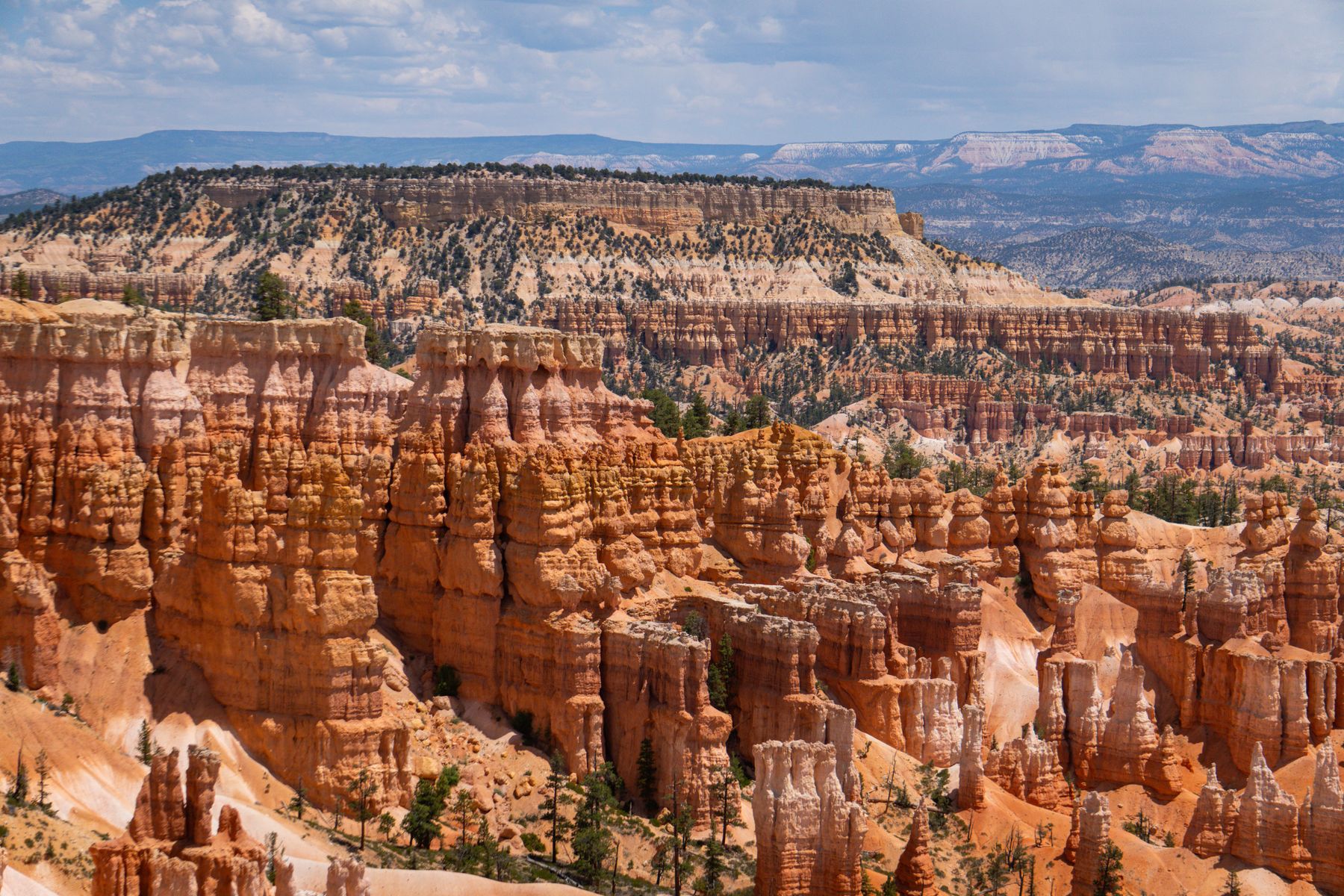
Walking among Bryce’s hoodoos gives you a different perspective from the rim viewpoints. The shapes feel taller and more detailed when the trail brings you into the amphitheater.
| Detail | Planning information |
|---|---|
| Best for | Rock formations and an established canyon loop |
| Route | About 2.9 miles for the standard combination |
| Start and map | Queen’s Garden Trailhead |
| Time to allow | About two to four hours with stops |
| Cost and booking | Park admission applies; confirm the open connection before starting |
| Access and nearby | Steep return sections, altitude, and seasonal ice require preparation |
The park recommends a clockwise direction for the usual loop, descending Queen’s Garden and returning via the appropriate Navajo connection. Wall Street is seasonal; confirm the usable route rather than assuming both Navajo sides are open.
7. Delicate Arch, Arches National Park
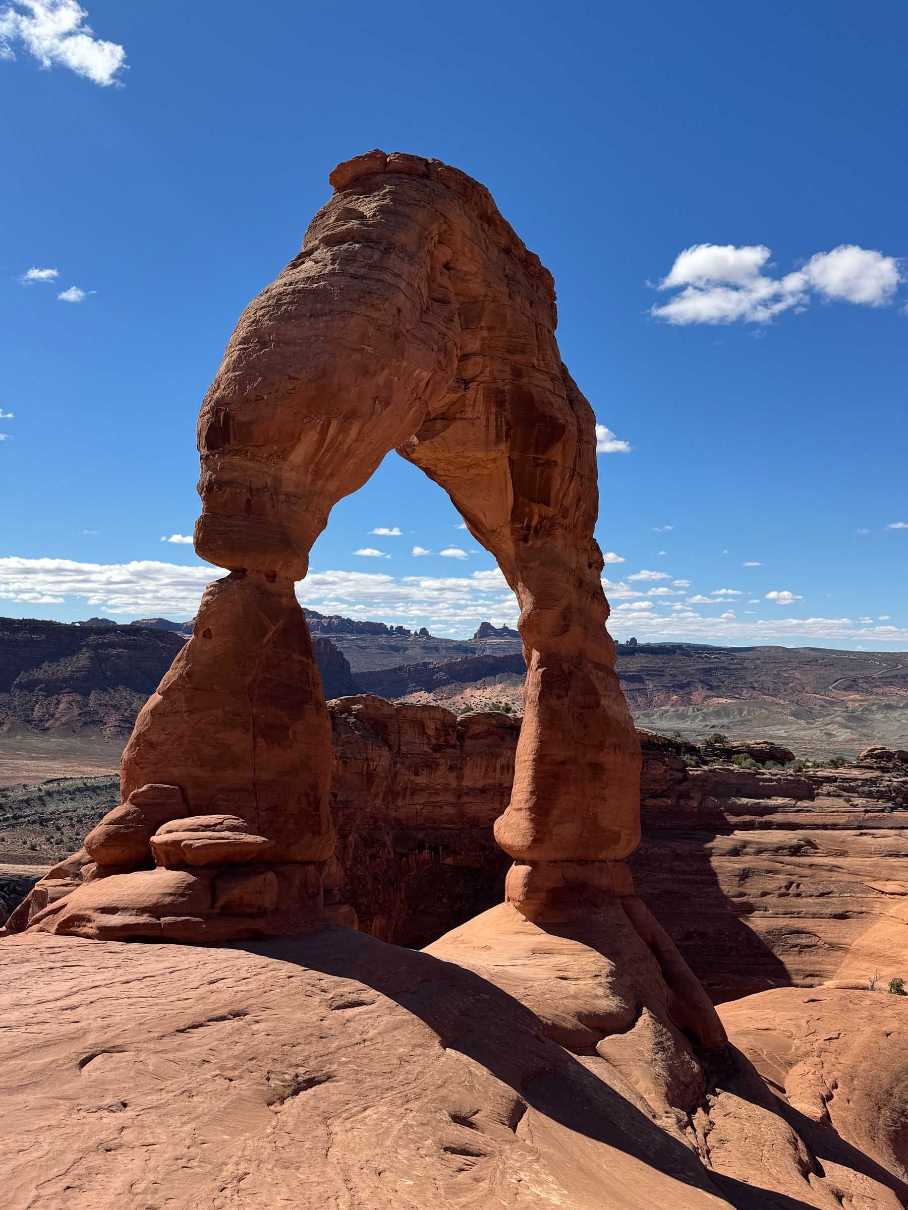
Delicate Arch is a memorable destination, reached by a route that includes exposed rock and limited shade. A short mileage figure can hide how tiring the outing becomes in strong sun.
| Detail | Planning information |
|---|---|
| Best for | Prepared walkers interested in a famous desert landmark |
| Route | About 3 miles return, with roughly 480 feet of elevation gain |
| Start and map | Delicate Arch Trailhead at Wolfe Ranch |
| Time to allow | Around two to four hours, adjusted for weather and fitness |
| Cost and booking | Park entry applies; check the current year’s vehicle-access rules |
| Access and nearby | Slickrock, exposure, and a narrow section require care; distant viewpoints are separate outings |
Carry sufficient water, follow the marked route, and keep away from edges. In winter, ice can make the narrow section particularly hazardous. Choose a shorter alternative when conditions do not suit your group.
8. Hall of Mosses, Olympic National Park
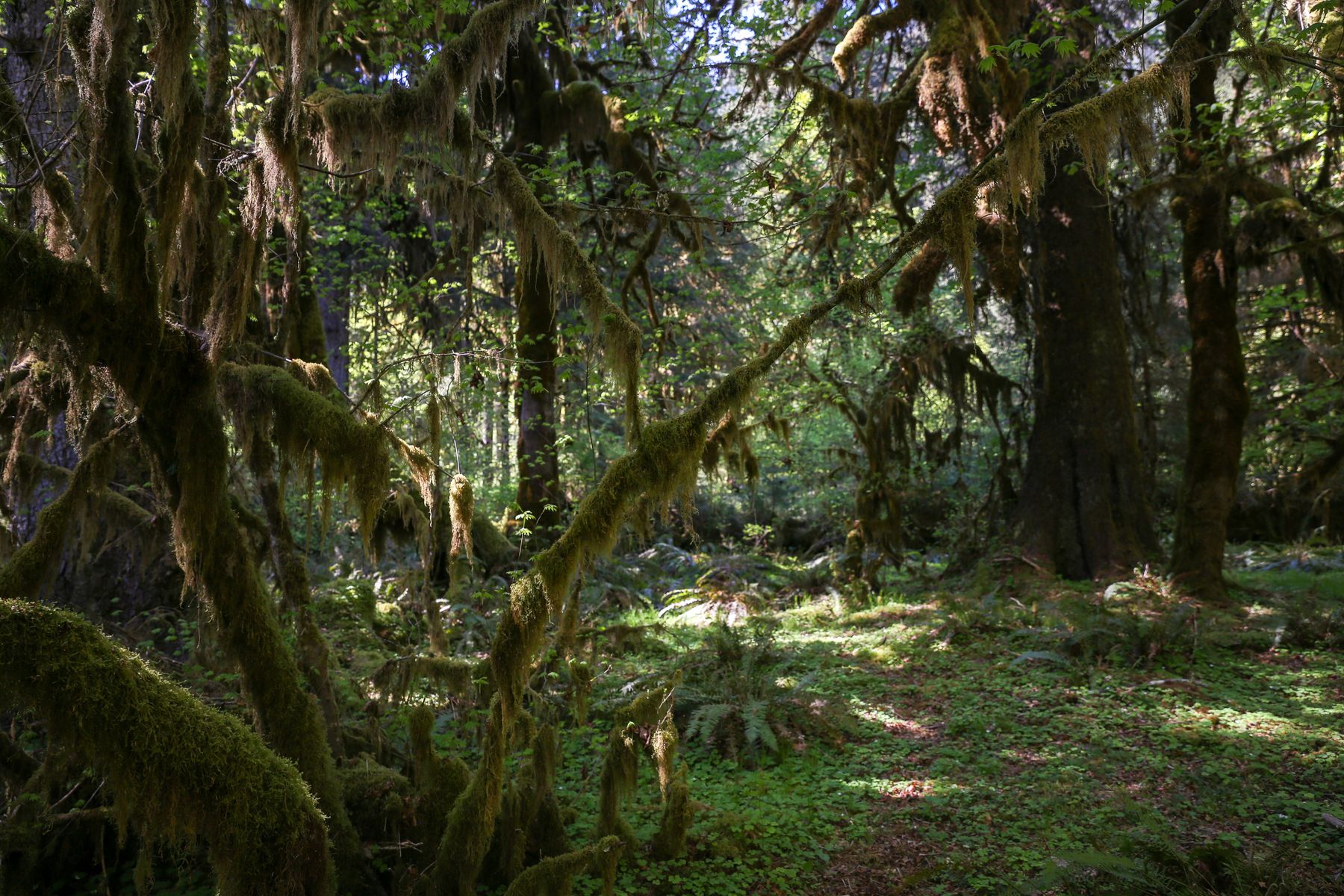
The Hoh Rain Forest is a place to slow down. Moss-covered branches, tall trees, and small details beside the path give a short outing plenty of interest. The photo shows the wider rainforest setting.
| Detail | Planning information |
|---|---|
| Best for | Forest scenery and a shorter walking day |
| Route | About 0.8-mile loop, plus the approach from the visitor-center area |
| Start and map | Hall of Mosses Trailhead |
| Time to allow | About 45–90 minutes |
| Cost and booking | Park admission applies; check road access, parking, and current closures |
| Access and nearby | Roots, wet surfaces, and a short steep section mean the loop is not a uniformly level route |
Bring a rain layer and footwear with grip. Stay on the path, protect the vegetation, and let quieter walkers pass without stepping into the forest floor.
9. Myrtle Falls, Mount Rainier National Park
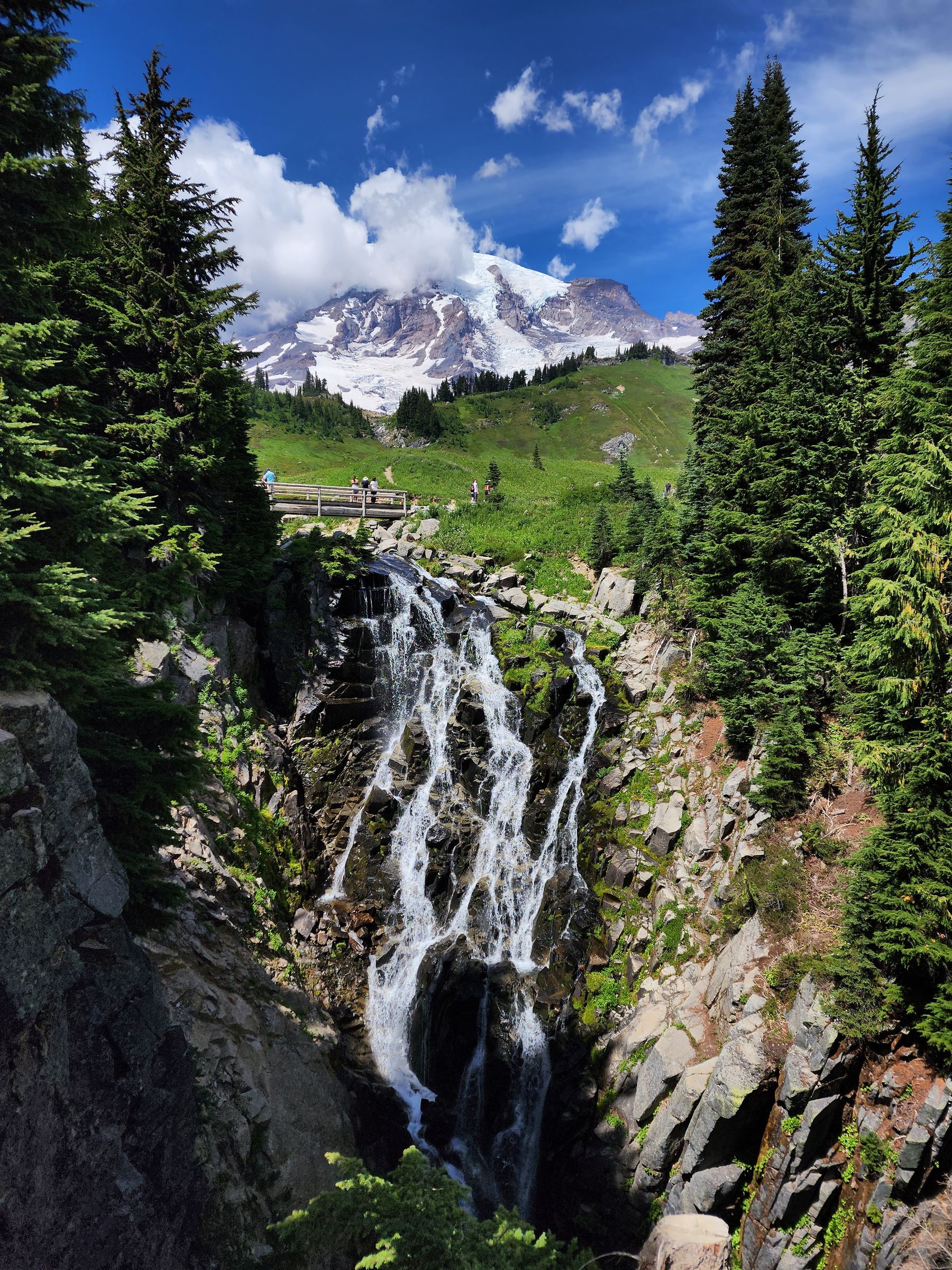
When conditions allow, this short Paradise-area walk combines a waterfall with a famous mountain backdrop. Cloud can hide the peak, while the waterfall and surrounding landscape still offer a worthwhile outing.
| Detail | Planning information |
|---|---|
| Best for | A shorter mountain outing during suitable snow-free conditions |
| Route | About 1 mile return from Paradise |
| Start and map | Myrtle Falls from Paradise |
| Time to allow | About 45–90 minutes, plus parking time |
| Cost and booking | Park admission applies; confirm road and access rules for your dates |
| Access and nearby | Paved sections have slopes, and the waterfall viewpoint includes steps; snow can cover the route |
Confirm the route with staff before walking across lingering snow. A summer photograph should not be used as evidence of conditions in another month.
10. Kuwohi Summit Trail, Great Smoky Mountains National Park
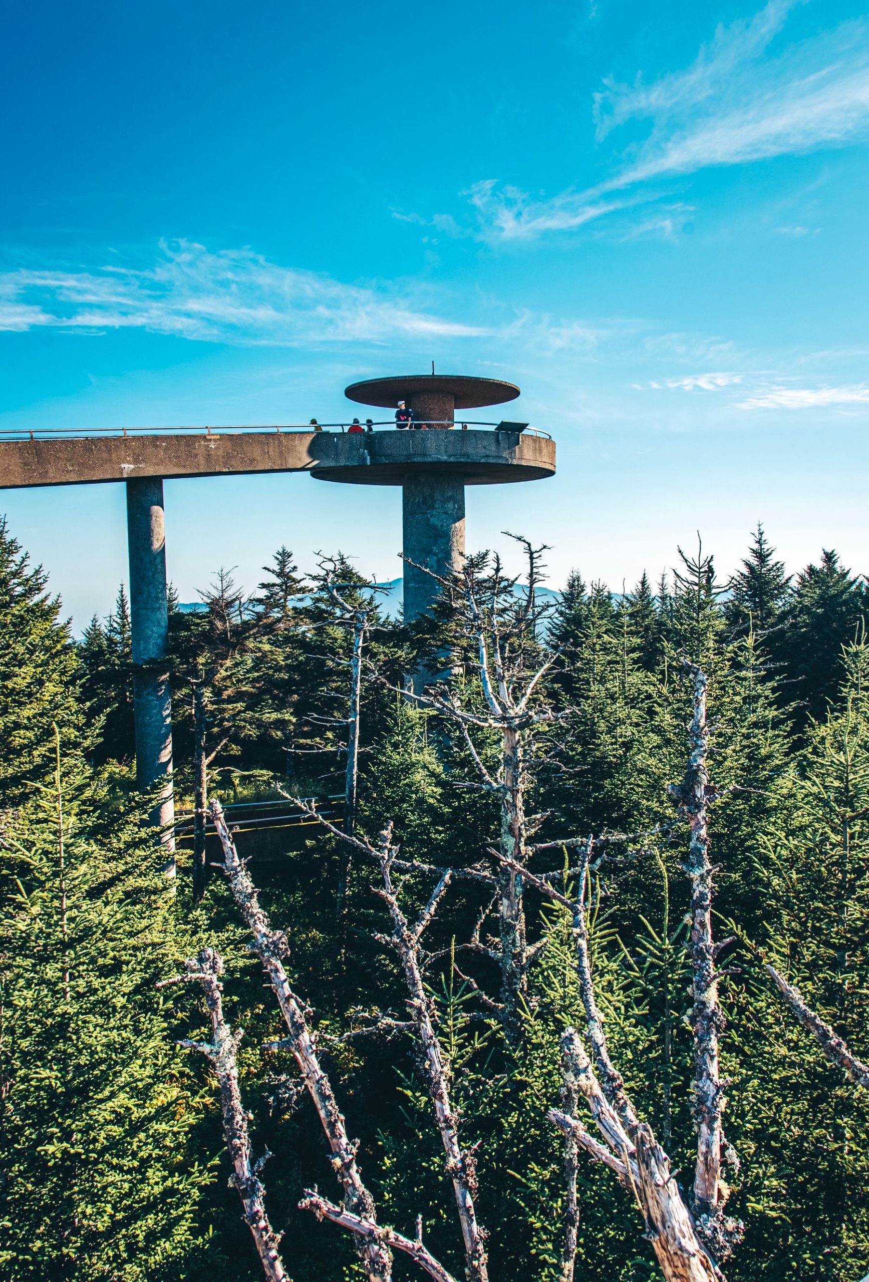
Kuwohi offers a mountain-view goal on a short paved path. The important detail is the grade: this is a steep climb, so leave time for breathers and a warm layer at the top.
| Detail | Planning information |
|---|---|
| Best for | A short summit outing for visitors comfortable with a steep path |
| Route | About 1 mile return from the parking area |
| Start and map | Kuwohi parking and summit trail |
| Time to allow | About one to two hours with rests |
| Cost and booking | The park has no entrance fee; a parking tag is required for parking longer than 15 minutes |
| Access and nearby | The path is very steep despite being paved; Kuwohi Road closes in winter |
Check visibility before committing to the drive. Fog can replace the long view, and crowded parking calls for patience or a different outing.
11. Angels Landing, Zion National Park
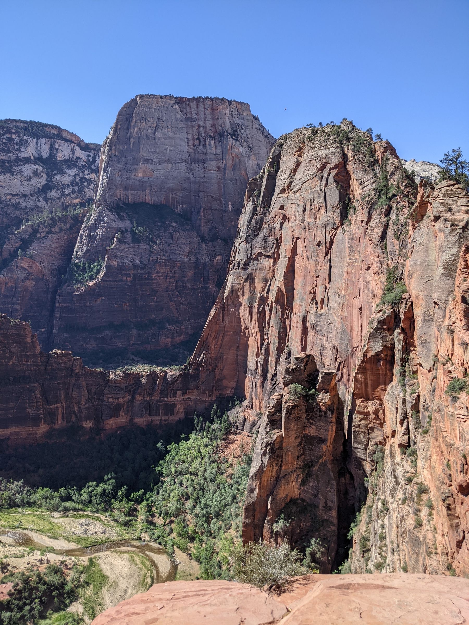
Angels Landing belongs in the demanding category. The final section has substantial exposure and chains, with limited room in places. It suits prepared hikers who understand the route and are comfortable turning around.
| Detail | Planning information |
|---|---|
| Best for | Experienced hikers comfortable with heights and exposure |
| Route | About 5.4 miles return, with roughly 1,488 feet of elevation gain |
| Start and map | The Grotto trailhead, Zion |
| Time to allow | A substantial day block, including access and rests |
| Cost and booking | A permit is required for the chain section beyond Scout Lookout; park entry and transport are separate |
| Access and nearby | Steep climbing and exposed terrain; check current closures and shuttle arrangements |
A permit does not make wet, icy, windy, or stormy conditions suitable. Choose a different route if anyone is uncomfortable with the exposure, and respect all permit boundaries.
12. Kilauea Iki, Hawaii Volcanoes National Park
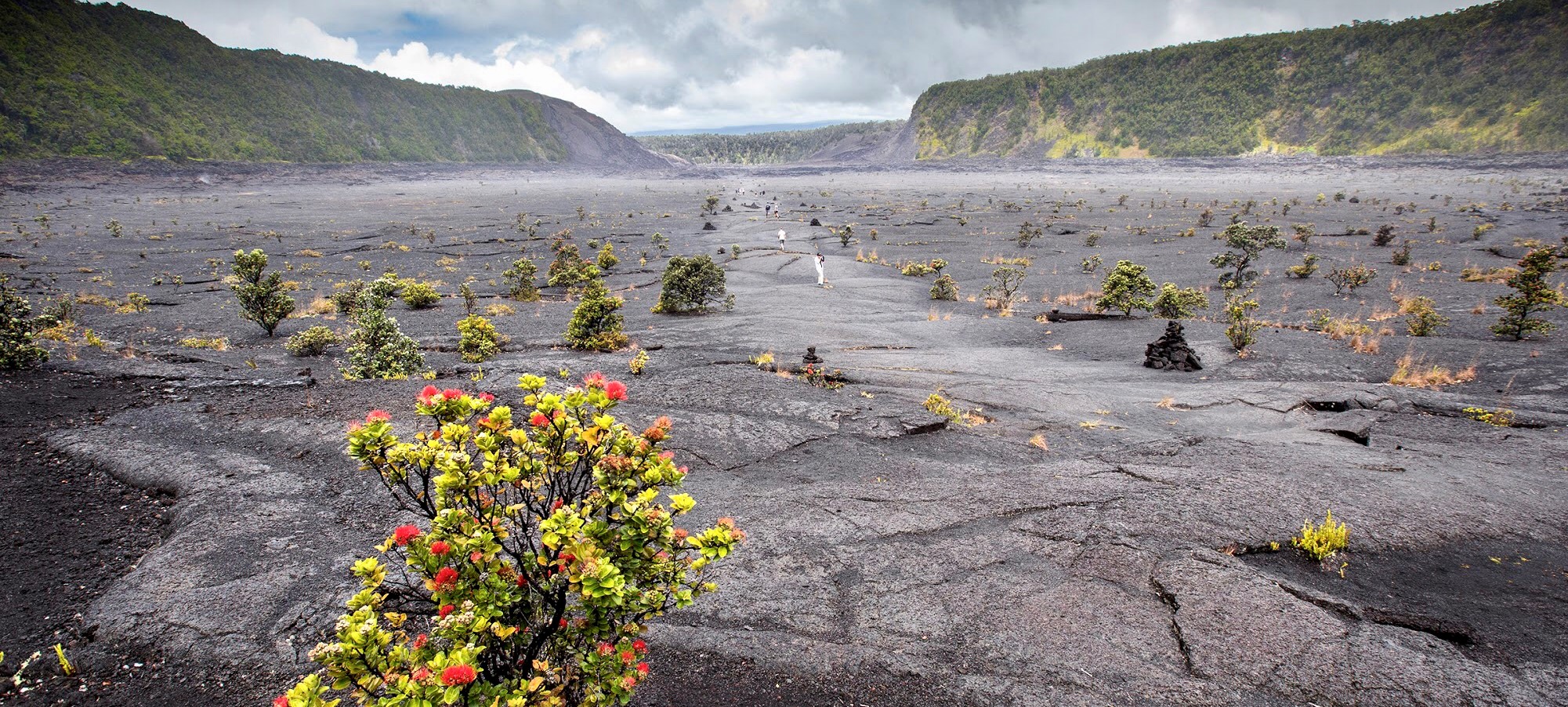
Kilauea Iki offers a striking change of scenery as the trail moves from forest to a solidified lava-lake floor. It is a good reminder that a hike’s interest comes from its setting as well as its length.
| Detail | Planning information |
|---|---|
| Best for | Volcanic landscapes and hikers comfortable with a steep descent and climb |
| Route | About 3.3-mile loop from Kilauea Iki Overlook; about 5.3 miles return from Kilauea Visitor Center |
| Start and map | Kilauea Iki Overlook |
| Time to allow | About two to three hours from the overlook, longer from other starts |
| Cost and booking | Park entry applies; check current volcanic, air-quality, trail, and parking alerts |
| Access and nearby | Rocky terrain and roughly 400 feet of descent and ascent; start point changes the route |
Carry sun and rain protection, follow established markers, and leave rocks in place. Do not enter a closed area to look for volcanic activity.
Best Time to Plan a U.S. Hiking Holiday
| Setting | Useful general approach |
|---|---|
| Desert parks | Favor suitable cooler periods; check heat, water, and flash-flood forecasts |
| High mountains | Confirm snow conditions and road openings rather than choosing by month alone |
| Pacific Northwest forests | Prepare for rain, mud, wind, and seasonal road impacts |
| New England coast | Check seasonal transport, weather, and crowded holiday periods |
| Smoky Mountains | Allow for fog, storms, icy high routes, and seasonal road closures |
| Hawaii volcano landscapes | Check volcanic alerts, air quality, rain, and trail access for the specific day |
Shoulder-season trips can offer quieter periods, but fewer services or snowy trails may change your options. Choose the conditions you can handle, then compare prices.
Booking, Permits, and Getting to Trailheads
Read the official manager’s page for the exact hike. Check these separately: park admission, timed vehicle access, parking, shuttle transport, and a route-specific permit. Keep a saved copy of every confirmation.
Angels Landing’s permit is specific to the restricted section. Bear Lake Road can have timed-access requirements in its operating season. Other parks change vehicle-access systems between years, so this guide does not assume that 2026 rules will continue unchanged into 2027.
A rental car is useful in many regions, but some busy park roads use shuttles or restrict private vehicles. Confirm the first and final return services. Map apps help find a trailhead; a suitable offline trail map is better for following the walking route.
Where to Stay and What to Eat
Choose accommodation by its practical route to the trailhead. A cheaper room on the wrong side of a mountain road can add hours to each day. Check breakfast hours, early check-out, parking, laundry, and the cancellation policy.
Campsites can provide a good base when reserved and equipped for the season. Confirm food storage, drinking water, toilets, and vehicle dimensions. A park pass does not include a campsite.
Carry a meal you can comfortably eat during the outing, plus extra snacks. Tell restaurants about allergies and check dietary options before arriving in a small gateway town. Do not rely on finding an open café at a trailhead.
Hiking Trip Itinerary Ideas
A Weekend or Three-Day Trip
Choose one park and one accommodation base. Use arrival day for an easy orientation walk, take a suitable main hike the next day, and keep departure day flexible. This works better than adding a long drive after every outing.
Four or Five Days in One Region
A Rocky Mountain base can combine Emerald Lake with lower-effort days chosen after arrival. A Yosemite visit can mix the Vernal footbridge with valley walks. Around Acadia, divide coastal walking, shorter outings, and time in town.
A Seven-Day Hiking Holiday
Consider two nearby bases, such as Olympic and Mount Rainier, with a genuine travel day between them. For a Utah trip, allow separate bases and travel time for Zion, Bryce Canyon, and the Moab area. Adapt each day to heat, permits, and energy.
Hawaii and Alaska need their own flight and local-transport plans. The 12 hikes in this article should be treated as choices for separate trips rather than a week-long checklist.
How Much Does a Hiking Trip Cost?
Sample Regional Budget for Two Adults
This example covers four travel days and three nights in one mainland region, a shared room and rental car, one standard park-entry allowance, and some basic equipment. Room and car allowances include estimated taxes and routine fees.
| Expense | Planning allowance |
|---|---|
| Accommodation: 3 nights × $180 | $540 |
| Food and groceries | $320 |
| Rental car | $280 |
| Fuel | $140 |
| Park entry allowance | $35 |
| Basic gear purchases or hire | $125 |
| Parking, permits, and local transport allowance | $60 |
| Subtotal | $1,500 |
| Contingency: 10% | $150 |
| Total for two adults | $1,650 |
Flights, major specialist equipment, guided expeditions, insurance, and extra nonresident charges are excluded. Some national parks charge additional fees to non-U.S. residents ages 16 and over in 2026 unless covered by a qualifying pass. Compare current rules for the parks you actually choose.
An existing-gear camping trip can cost less than a room-based visit. A remote or guided trip can cost much more. Price the whole journey before deciding that a trail is inexpensive because the walk has no separate ticket.
Family, Solo, Group, and Accessible Hiking
Families can choose a clear turnaround, frequent snack stops, and a route suited to the child who tires first. Keep children close near water, edges, and busy roads.
Solo hikers should leave their route, start point, turnaround time, and expected return with a trusted person. Groups should stay together or agree a clear plan that does not leave anyone unsupported.
For accessible outings, confirm the exact surface, slope, width, steps, restroom, and parking arrangements you need. Barker Dam has rocky footing, Hall of Mosses has steep sections, Myrtle Falls has viewpoint steps, and Kuwohi is steep despite its paving. Ask park staff for a suitable alternative where needed.
What to Pack and How to Prepare

Carry water appropriate to the route and conditions, food, suitable shoes, layers, rain protection, sun protection, navigation, a headlamp, a first-aid kit, and personal medication. A charged phone and portable battery are useful alongside offline maps.
Check the weather for the trail’s elevation, set a turnaround time, and tell someone your plan. Read local guidance for bears, heat, lightning, snow, volcanic gases, and river hazards as relevant. Do not assume clear weather at your hotel means a mountain route is safe.
Use only the treatment method appropriate to any water you intend to collect; carrying enough from a confirmed safe supply is often simpler for a short day hike. Follow local sanitation and waste rules, and carry out everything you bring.
Photography and Trail Etiquette
Stop where you can stand securely and leave room for others. Keep away from cliff edges, waterfalls, and wildlife. A viewpoint should remain usable for the next person.
Stay on established paths, respect closures, and leave plants, rocks, and cultural objects in place. Keep noise low and follow the manager’s rules for dogs, drones, bikes, fires, and group size.
Important Contacts and Planning Resources
| Need | What to save before leaving |
|---|---|
| Immediate emergency | 911; reception may be absent |
| Local route advice | The park visitor center or managing ranger station |
| Current trail and road alerts | The relevant park’s official conditions page and saved NPS app information |
| Permit problem | The issuing reservation provider and confirmation number |
| Transport problem | Your shuttle, tour, or rental-car provider’s direct contact |
| Check-in plan | A trusted person with your route and expected return time |
Do not rely on a general visitor-information number as an emergency dispatch service. Know how you would communicate from the specific area you are entering.
Common Hiking-Trip Mistakes
- Choosing by distance alone.
- Mixing one-way, loop, and return mileage.
- Treating a short paved path as automatically accessible.
- Arriving without the required permit or vehicle reservation.
- Forgetting the return climb, last shuttle, or approach walk.
- Hiking a summer route using winter assumptions.
- Continuing because a famous destination feels close.
- Planning trails in distant states without allowing travel days.
Frequently Asked Questions About U.S. Hiking Trips
Which Trail Is Best for a Beginner?
Choose by your current fitness, comfort, and the conditions. A shorter suitable route such as part of Ocean Path or Barker Dam may work well, but surfaces, weather, and slopes still need checking.
Are These Trails Open Year-Round?
Access varies. Snow, storms, fires, repairs, volcanic conditions, and seasonal road closures can affect individual routes. Check the current notice immediately before hiking.
Do I Need a Guide?
Many visitors hike established routes independently when properly prepared. A qualified local guide can help with logistics, interpretation, and unfamiliar conditions. Ask about the actual route, qualifications, and cancellation policy.
Does a National Park Pass Include Permits?
Usually it covers eligible entrance charges according to its terms. Trail permits, campsites, parking, transport, and timed reservations can be separate. Check each item.
Can I Take a Dog?
Rules vary, and many national park hiking trails restrict pets. Check the exact trail’s policy and arrange a suitable alternative before arriving.
How Do I Choose a Safe Turnaround?
Consider the weather, daylight, route condition, return climb, water, group pace, and transport deadline. Set a limit before starting and turn back earlier when conditions or energy change.
Your Final Hiking-Trip Checklist
- Choose one practical region and a suitable season.
- Confirm route distance, start point, surface, and elevation changes.
- Book accommodation, permits, timed access, and transport as needed.
- Read current alerts and the route-specific forecast.
- Save offline maps and a shorter alternative.
- Pack appropriate equipment, water, and food.
- Share a route and return time with someone you trust.
- Leave enough time and energy for the journey back.
Reader Questions and Travel Experiences
Which landscape would you choose for your next walk: coast, forest, desert, mountain lake, or volcanic crater? Share a route you have completed, the month you visited, and a useful detail about the conditions.
Explore More Travel Guides
Plan a wider trip with Top 20 National Parks to Visit in the United States, Best Things to Do in Yosemite National Park, and our Grand Canyon Travel Guide for First-Time Visitors.
You may also enjoy Most Beautiful Waterfalls in the United States and Top Camping Destinations in the United States.
Leave a Reply
What would you like to know before you go?
Send us your question, feedback, or a place you would like to see covered.
Ask a travel questionFrom fellow travelers.
-
A really useful round-up — the practical notes on permits and timed entry are what most lists skip. Emerald Lake is a great example: it looks short on paper, but the altitude from Bear Lake catches people out, so an early start and a slow pace matter. For Delicate Arch, going at sunrise or late afternoon makes a big difference in the heat, and for Angels Landing the permit lottery means planning weeks ahead. In northern Pakistan we see the same pattern on our Hunza and Skardu treks — the best season is usually late spring and early autumn, when the trails are clear but the crowds and the heat have eased off.

Leave a Reply